AI Use Cases in Real Estate Development and Land Subdivision
Where AI helps in real estate development and land subdivision: parcel screening, due diligence, subdivision layouts, and buyer follow-up inside your stack.

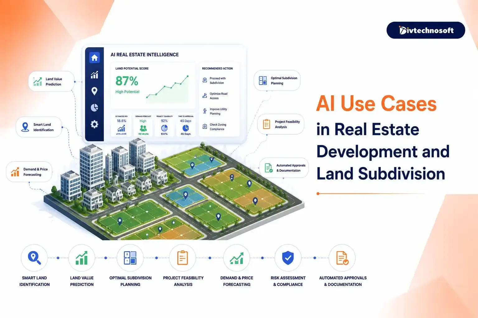
Blown pro formas and stalled projects rarely come from bad land. They come from information moving more slowly than the deal: diligence findings buried on page 240 of a title package, a subdivision layout redrawn five times because a setback issue surfaced at county review, a serious buyer inquiry sitting unanswered over a weekend. This page walks through where AI genuinely helps at each phase of the development lifecycle, and how it fits alongside the systems your team already uses.
Faster parcel screening and due diligence
Subdivision layout scenarios with cost estimates
Continuous zoning and compliance checks
Lead qualification and buyer communication that never sleeps
Where Development Deals Actually Lose Time and Margin
An analyst closes about one deal for every hundred parcels reviewed. Most of the hundred die in the same place. The team spends weeks pulling county records, reading title commitments, and rebuilding the same comp spreadsheet. Only then does someone with authority look at the site.
Meanwhile the land team is on its fourth layout revision. A density miscount from revision two only showed up in the engineer's check. And the sales office follows up on Tuesday with a buyer who emailed Friday night.
The delay is not rare. According to a 2026 NAHB study, 94.2% of land developers said regulation caused delays, averaging about seven months. Roughly 74% of land and lot development cost is financed. So each month of delay adds loan interest to the deal.
The people are sharp. The process is what lags. The information existed the whole time. It sat in the county GIS layer, the easement clause, the ordinance table, and the CRM. It just reached the right person too late to change the outcome. The deal pays for that lag in redesign fees, dead diligence costs, and slow lot sales.
Why Development Data Is Finally Machine-Readable
Development data has always been rich but hard for software to read. Parcel records sat in county portals built in 2004. Title packages, reports, and CC&Rs ran to hundreds of dense pages. Site constraints lived across three consultants' files.
Two things changed. Large language models can now read a 300-page diligence package the way an analyst does. They flag easements, deed restrictions, and title exceptions, and they quote the source clause. This takes minutes, not days.
Spatial analysis now runs on its own too. It maps slope, FEMA floodplains, utility access, and buildable area. It no longer needs a GIS specialist for each question. Add layout tools that score subdivision options against zoning rules. The raw material for automation now exists in machine-readable form across the whole lifecycle
AI Use Cases Across the Development Lifecycle
Where AI helps depends on the phase. What follows is organized the way a project runs.
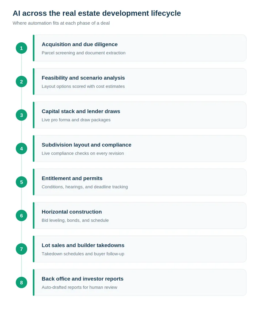
Land Acquisition and Due Diligence
Parcel screening is the clearest early win. AI watches listing feeds, county transaction records, and public data like population trends, permit activity, and new infrastructure. It scores each parcel against your criteria: target zoning, minimum acreage, utility access, and location. Your analysts open the week with a ranked shortlist in the CRM. No more browser full of bookmarks.
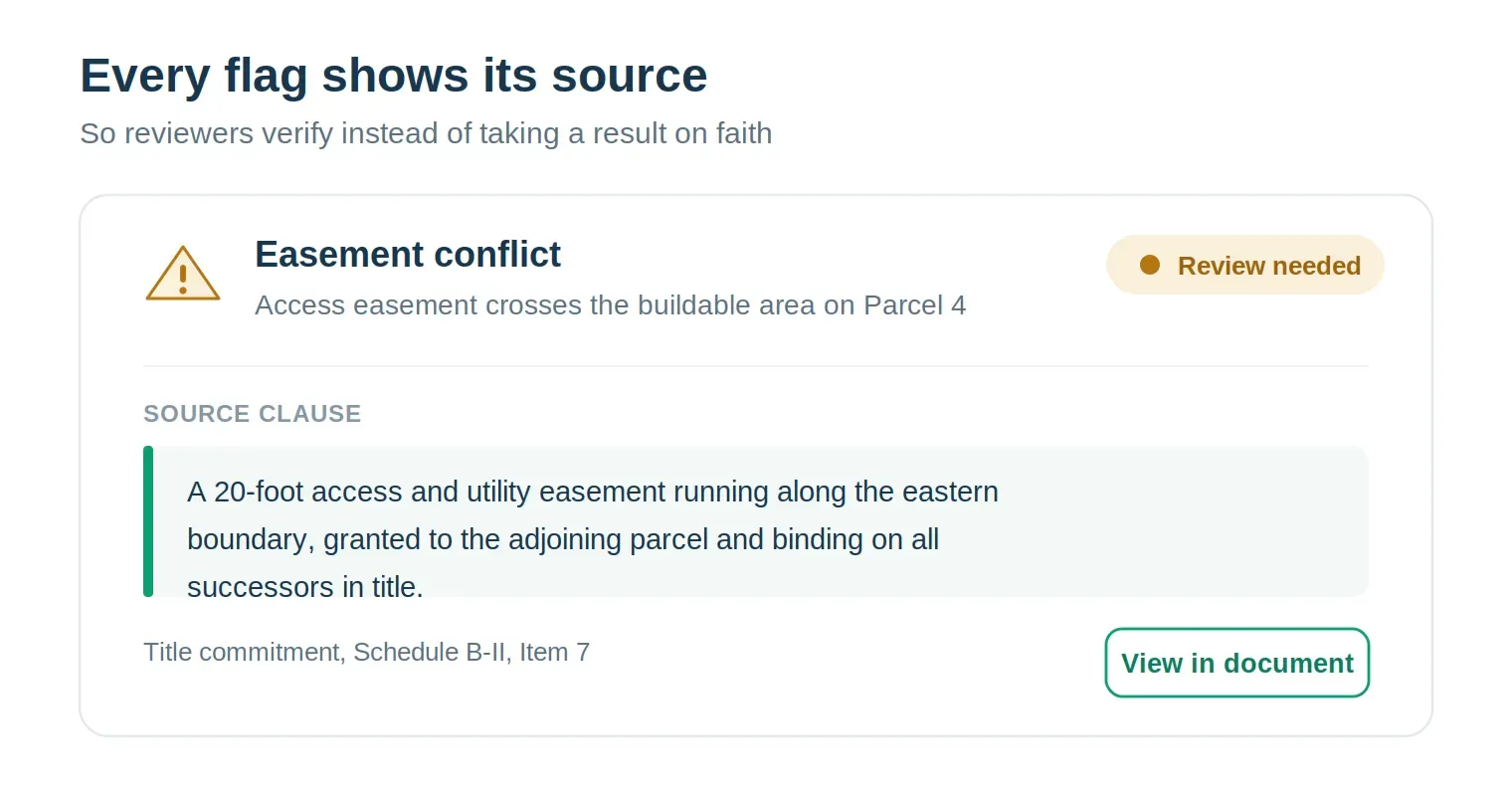
Document review comes next, and it pays off fast. A diligence pass pulls out easements and encumbrances with the granting language quoted. It flags deed restrictions that clash with your plans. It surfaces title exceptions and pulls lien or litigation history. This runs onretrieval-based document reading, not a keyword skimmer. The analyst walks into review knowing where the problems are on day two, not day twelve.
Valuation and risk come last. AI adjusts comparable land sales for entitlement status. It estimates land value under different programs. It flags flood exposure, slope, and wetlands. Treat these as signals, not verdicts. A model can tell you a parcel prices above comps. It cannot tell you the seller is retiring and will take terms.
Feasibility and Scenario Modeling
AI can model what the land supports before you spend on engineering. Give it the constraint map and your local rules: lot size, road frontage, setbacks, density caps, and open-space ratios. Layout tools then produce candidate plans. Each plan is scored on yield, infrastructure cost, and compliance. The team debates three worked options instead of reacting to one draft.
Task | Scenario A | Scenario B | Scenario C |
|---|---|---|---|
Program | 120 lots, higher density | 95 larger lots, premium positioning | Mixed-use: commercial frontage + residential |
Road network | Grid, shorter total length | Curvilinear, more frontage per lot | Split access, signalized entry |
Infrastructure cost | Lower per lot | Higher per lot | Highest, phased |
Compliance status | Passes density; open space marginal | Passes all checks | Frontage parcel needs rezoning |
Revenue model | Volume-driven | Price-driven | Blended, longer absorption |
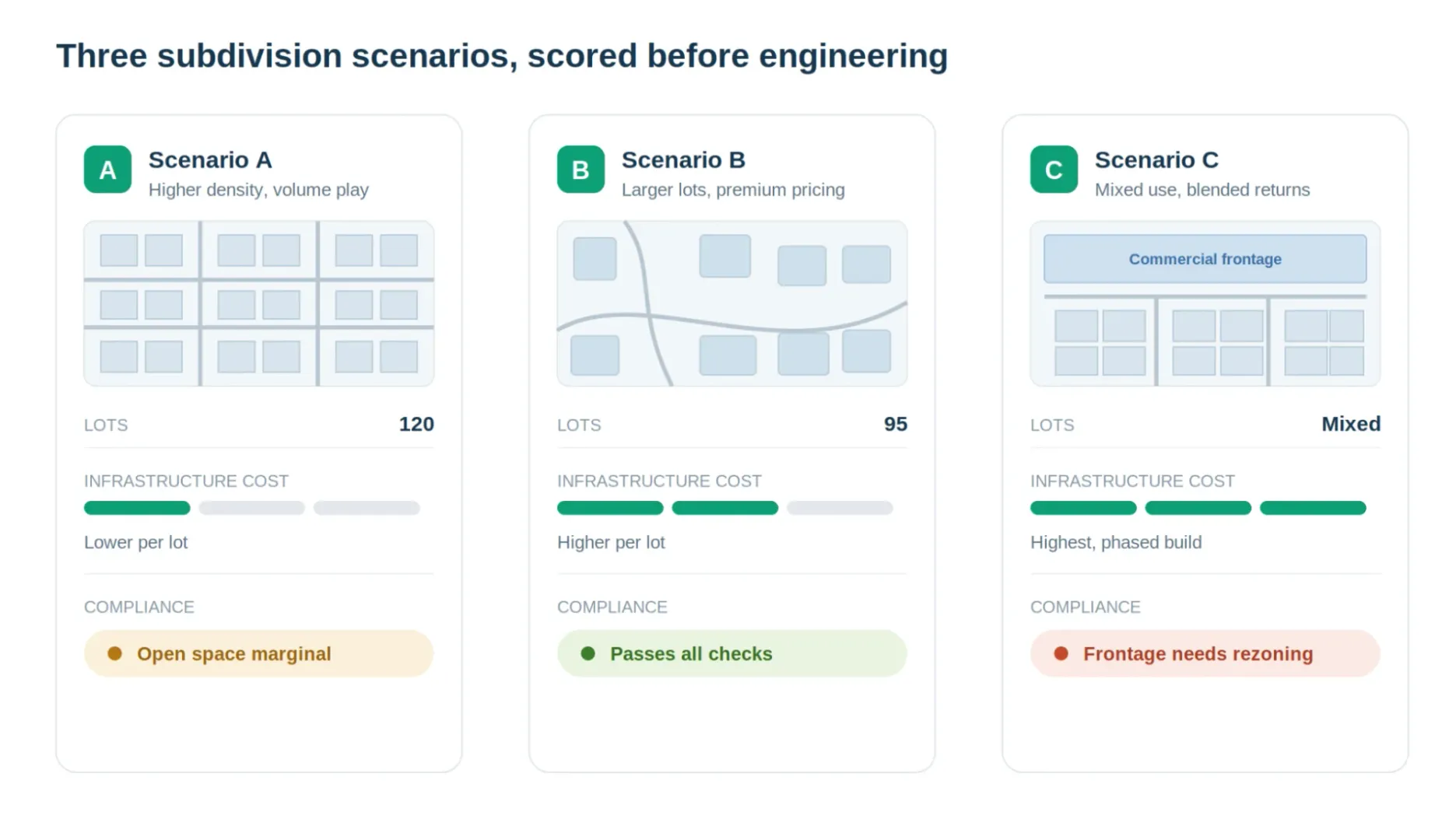
Each scenario carries a cost estimate for roads, water, sewer, storm, and earthwork. It also carries an absorption forecast from local demand data.
Capital Stack and Lender Draws
Capital is where a strong pro forma meets reality. AI keeps the pro forma live against actual costs and sales. It assembles lender draw packages from field data and invoices. It flags budget variance before a draw request goes out. Since most of the cost is financed, a clean draw and an accurate pro forma protect the whole deal. Equity partners get the same numbers without a manual rebuild each month.r.
Subdivision Layout and Compliance
Once you pick a direction, the compliance layer keeps working. Every revision gets re-checked the moment it changes. It checks setbacks, lot dimensions, road widths, and open-space rules. Violations surface at revision time, not in a county comment letter three months later. That one change turns four or five redesign rounds into two.
There is a limit worth naming. AI checks a layout against written rules. It cannot read an ambiguous ordinance or win a variance. Those calls stay with your civil engineer and land-use counsel.
Entitlement and Permits
Entitlement is where subdivision deals stall, and the data shows it. Application packets build themselves from project data. Submission status is tracked per agency. But the bigger win is risk tracking.
AI watches conditions of approval and their deadlines. It follows public-hearing and comment-period calendars. It monitors agency review cycles, will-serve letters, and study milestones. A deadline that would slip quietly gets flagged while there is still time to act.
The paperwork burden differs by market. In the USA, the work is county-by-county submission rules and a clean record of every planning-department exchange. In India, the friction is the land records themselves: ownership checks across state portals and RERA files. There, the win is turning one person's know-how into a standard digital process.
Horizontal Construction
Once the plat is approved, the subdivision gets built: grading, wet and dry utilities, and paving. AI levels bids across those trades so you compare like with like. It tracks improvement and performance bonds and their release conditions. It follows the schedule against the recorded plat and flags a slip that would push lot delivery. Change orders and field questions get logged and routed, not lost in email.
Lot Sales and Builder Takedowns
Who the buyer is changes the workflow. Most finished lots sell to production or regional builders on a phased takedown schedule. AI tracks takedown pace, deposit and escrow milestones, and lot-delivery dates against horizontal progress. A builder falling behind the contract gets flagged before it becomes a cash-flow problem. Land bankers and equity partners see the same schedule live.
Direct lot sales work differently. A custom-home buyer or broker emails on Friday at 9 p.m. AI qualifies, answers, and routes it before Monday. It scores budget and timeline, logs the contact in the CRM, and schedules follow-up. Your team picks up warm, documented conversations, not cold form fills. We built the same lead-matching engine into areal estate CRM for brokers. After the sale, buyers get scheduled progress updates and document packages with no manual assembly.
Back Office and Investor Reports
Monthly investor reports stop being an assembly job. Budget actuals, sales absorption, and milestones pull from the systems where they live. They draft into your report format and wait for human review before sending. Contract and vendor review works like diligence. The risk-shifting clauses get caught at signing, not remembered in a dispute.
Where Humans Stay in Charge
AI narrows and prepares. People decide. A licensed civil engineer still refines and stamps the final plat. Your land-use counsel handles variances and any ambiguous code. Every consequential output routes through a named human reviewer, with the AI's reasoning shown so the reviewer can verify it.
A 120-Acre Parcel, From Shortlist to Plat
Here is how the phases connect on one deal. The numbers are illustrative.
A 120-acre parcel lands on the Monday shortlist. It scored high on zoning, utility access, and a growth corridor. A diligence pass flags a 20-foot access easement on the east boundary and quotes the clause. Counsel confirms it in a day, not two weeks.
Feasibility returns three layouts. The 95-lot premium plan passes every check, so the team runs its pro forma against it. Capital closes with a live draw schedule attached.
Entitlement tracks nine conditions of approval and two hearing dates. None slip. Horizontal construction levels bids across grading and utilities, and the bonds post on time.
Two builders take down lots in phases. The CRM tracks their pace against delivery dates. Monthly investor reports draft themselves from the same data. A person reviews and sends.
What It Connects To
The AI layer does not replace your systems. It reads from them and writes back to them. Here is where the data comes from and goes.
Source system | What AI reads | Where it writes back |
|---|---|---|
Esri ArcGIS or QGIS | Parcels, slope, floodplain, utility layers | Buildable-area and constraint maps |
County assessor and recorder portals | Ownership, transactions, liens | Screening scores in your CRM |
Parcel data providers | Comps, zoning, land attributes | Ranked acquisition shortlist |
Salesforce or HubSpot | Leads, contacts, deal stages | Qualified leads and follow-up tasks |
Procore or Buildertrend | Budgets, schedules, field data | Draw packages and variance flags |
Civil design files | Layout revisions, lot geometry | Compliance check results |
Extend Your Stack or Buy a Standalone AI Tool
Most teams already run some mix of ArcGIS or QGIS, Salesforce or HubSpot, Procore or Buildertrend, and a folder of diligence PDFs. That shapes the real question. It is rarely which AI tool to buy. It is whether to bolt a tool next to that stack or build a custom layer on top of it.
Standalone AI point tool | Custom layer on your stack | |
|---|---|---|
Setup speed | Fast, works out of the box | Slower to start, bulk for you |
Data flow | Another silo, another login | Reads and writes to your GIS, CRM, and storage |
Coverage | Great where supporting layouts, or isode | Covers acquisition planning, and close |
Country data | Handles the countries it was built for | Scraped in the countries you operate in |
Cost model | Per seat or per parcel | One-time build plus maintenance |
Ownership | Vendor owns platform and logic | You own the code and the data |
Buy the point tool if you close two deals a year with a three-person team. Or keep the spreadsheet. A custom layer earns its cost in three cases. When you screen twenty or more parcels a quarter. When you work across many counties with different data quirks. Or when you lose real money in the gaps between systems that do not talk today.
How to Adopt This Without Risking a Live Deal
These projects rarely fail because of the model. They fail because a team automates everything at once. Then it has nothing to compare against. Land development has no sandbox. So the first workflow runs beside the current process. Start with one workflow, usually parcel screening or diligence review. Both produce output an analyst can check against work they already did. Run it beside the manual process for a full deal cycle. Compare. Then expand.
The real risk is trust, not technology. An analyst who doubts the flags will re-read every document anyway. Then you have bought nothing. So every flag shows its source: the clause, the data point, the rule. That way reviewers verify instead of guessing.
First comes a short discovery phase through ourProduct Strategy Services. It confirms which workflow to automate first. It also confirms what your counties' data really looks like. That data is the least standard part of the whole stack. Better to learn that in scoping than in week three. Divtechnosoft then delivers a working, testable version in 6 to 8 weeks through ourMVP Development Services. You own the code from delivery. Our support team keeps the integrations current as county portals, ArcGIS, and CRM APIs change underneath them.
FAQ
Can AI actually generate a usable subdivision layout?
It generates strong candidates and scores them against codified rules and cost estimates, which removes most early redesign cycles. A licensed civil engineer still refines and stamps the final plat. Treat the output as a starting point that arrives pre-checked, not a finished plan.
Is AI reliable enough for acquisition decisions?
Reliable for screening, extraction, and flagging- the work of narrowing and preparing. Not appropriate as the decision-maker. Every consequential output routes through a named human reviewer, with the AI's reasoning visible so the reviewer verifies rather than trusts.
How does it handle different zoning rules across counties?
Ordinances are ingested per jurisdiction, so each project checks against its own county's or municipality's rules. Codified provisions like setbacks, lot dimensions, and density automate well. Ambiguous or discretionary language gets flagged for your land-use counsel instead of guessed at.
What data do we need before starting?
Less than most teams fear. A working CRM, access to wherever your diligence documents live, and your written acquisition criteria are enough for the first workflow. GIS layers and historical deal data sharpen results but are not prerequisites.
We already run ArcGIS and Salesforce. Does this replace them?
No, it connects them. The AI layer reads from and writes back to what you already run. The gap is almost always in the workflow between systems, not the systems themselves.
What about counties with messy or offline records?
This is the real constraint, and we scope it before building. Some counties expose clean APIs; others need document-level extraction from scanned records. Which jurisdictions you operate in shapes the build more than any model choice does.
How long until we see a working version?
6 to 8 weeks for a focused build of your first workflow, run in parallel with your current process on live deals. Expansion is phased based on what that first cycle shows.
Walk Us Through One Deal Workflow
The useful first step is small: a short session mapping one workflow, usually parcel screening or diligence review, to see whether automation is worth it for how your deals actually run. If a spreadsheet or an off-the-shelf tool already covers it, we will tell you so.